

An Screig Mhor [Scraigs]
Good walks are even better shared.
Overview
An Screig Mhor [Scraigs] Overview
An Screig Mhor, affectionately known as 'Scraigs', is a magnificent Munro soaring to an elevation of 882 meters. Nestled in the rugged Scottish Highlands, this mountain is not only a gem for seasoned hikers but also offers breathtaking views for those who dare to conquer its heights.
Geology
The geology of An Screig Mhor is fascinating, primarily comprised of ancient volcanic rock that has stood the test of time. You’ll encounter a mix of rocky outcrops and lush grasslands, but watch your step! While the rocky formations provide a delightful backdrop, they can also be a bit uneven—perfect for a surprise trip or two!
Routes
West Highland Way to An Screig Mhor
This route is perfect for those looking to challenge themselves, measuring about 10.5 km in distance and requiring around 4.5 hours to complete. The path follows part of the historic West Highland Way, immersing hikers in stunning glens and serene landscapes. Just sprinkle in a little effort, and you’ll be rewarded with views that might make you forget about that last chocolate biscuit!
Summit Features
At the summit, you’ll find a robust cairn, a beacon of camaraderie where fellow hikers leave pebbles as tokens. The trig point enhances the thrill of reaching the top—feel free to take that triumphal selfie!
Terrain Type
Expect a delightful mix of rocky and grassy terrain, with patches of hidden bogs where your Fancy Wellies might come in handy. While it’s best to keep your feet on dry land, a little dance in a puddle could be just the spirited start to your adventure!
Views
The views from An Screig Mhor are nothing short of spectacular. You can gaze at the stunning landscape that sprawls across Loch Awe and admire Ben Cruachan from afar. For the best picture-perfect moments, spring and autumn are your best bet. But let’s be honest; any time spent at this height is time well spent!
Hazards
Despite its beauty, nature can throw a curveball. Loose rocks and highly variable weather could turn your joyful hike into a worm-chasing experience! Be sure to check the weather forecasts and pack accordingly.
Nearby Summits
If you’re feeling bold, consider tackling nearby peaks such as Ben Cruachan, the formidable giant at 1126 meters, or the slightly less daunting Beinn Fhionnlaidh at 860 meters.
Access
Accessing An Screig Mhor is a breeze! There’s a quaint little parking spot near the trailhead, but arrive early to secure your space on busy weekends. Public transport is available from Oban, with buses venturing to the charming village of Dalavich, where your adventure begins.
Facilities
While the mountains might not boast five-star accommodations, Oban is just down the road and offers cafes and intriguing shops to fill your belly and rest your weary feet. Don’t forget to indulge in a wee treat before you head into the wild!
History
The name 'An Screig Mhor' is steeped in rich history, translating to 'The Great Pinnacle'. This noble title pays homage to the mountain's stature in both the landscape and local lore.
In sum, An Screig Mhor promises a fulfilling and scenic adventure for hikers looking to explore the enchanting Scottish Highlands. Pack your walking boots, bring a sense of adventure, and may your spirits be high as you ascend this majestic peak!
Explore routes near An Screig Mhor [Scraigs]
Public walks starting within 80 km of this hill. Nearby does not mean a route reaches the summit; check its map and access before setting out.
Derry~Londonderry City Walls Circuit
View route
Florence Court: Riverside and Forest Circuit, County Fermanagh
View route
Banagher Glen and Forest: complete higher-return circuit
View route
Route planning notes
These notes describe possible approaches, not verified navigable routes or permission to cross land. Check current paths, local access rules and conditions before setting out.
West Highland Way to An Screig Mhor
This route follows parts of the West Highland Way and ascends through scenic glens and rugged terrain.
Make a day of it, together
Find someone to share the walk with, or organise a day out along a route you like.
Photo Gallery
View all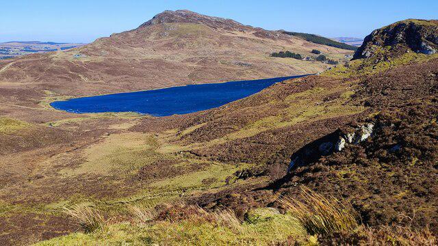 Photo could not load
B9301 : Lough Muck and Scraigs
Robert Bone
Hill facts and local notes
Classifications
Elevation
428m
1,404 ft
Prominence
234m
Coordinates
54.8594, -8.1035
B934013
OS Map
11
At the Summit
The summit is crowned with a large rock cairn, often adorned with the occasional pebble left by fellow hikers. There's also a small trig point marking the highest point.
Terrain & Geology
An Screig Mhor is primarily composed of ancient volcanic rock, with sweeping vistas that reveal the rugged beauty of the Highlands. The summit presents an array of rock formations that are remnants from a time when this area was part of a fiery geological process.
Views & Scenery
From the summit, hikers can enjoy spectacular views over Loch Awe and the surrounding mountain ranges, including Ben Cruachan and the majestic peaks of the Trossachs.
History & Heritage
Name Origin
The name 'An Screig Mhor' translates from Gaelic as 'The Great Pinnacle', a fitting description for its towering presence in the landscape.
Historical Significance
The mountain holds cultural significance for the local communities and hikers alike, often celebrated in folk tales and songs of the Highlands.
Getting There & Facilities
Check current local access restrictions, parking rules and transport timetables before travelling. These notes do not confirm public access to the summit.
Parking
There is a small parking area near the start of the West Highland Way at the base of the mountain, which accommodates several cars but can fill up quickly on weekends.
Public Transport
Buses run regularly from Oban to the nearby village of Dalavich where the trail begins; check local schedules for the most current information.
Nearby Facilities
The nearest facilities are located in Oban, where you'll find a variety of cafes, shops, and restrooms. Perfect for stocking up on snacks before your ascent!
Safety Information
Known Hazards
- Loose rocks and challenging weather conditions can make navigation tricky. Always keep an eye on the weather—it's known to change faster than you can say 'highlands'.
General Safety Tips
- Check weather conditions before setting out
- Carry appropriate clothing and equipment
- Let someone know your planned route
- Take a map, compass, and GPS device
- Carry emergency supplies: food, water, first aid kit, torch
Hills
Some common questions about the hills answered
Are there group walks up An Screig Mhor [Scraigs]?
Many walkers use Walkmates to join or organise walks with others. You can check for group walks around An Screig Mhor [Scraigs] through the maps
Are there other walkers around An Screig Mhor [Scraigs]?
Activity varies by location and time, but Walkmates lets you see whether others have shared walks or shown interest in this area. Find other people through the walking friends search walking friends for An Screig Mhor [Scraigs] search or of course create your own walk for An Screig Mhor [Scraigs]
Can I organise a walk to An Screig Mhor [Scraigs]?
Yes. If there aren’t any walks listed already, you can create a walk and make it available for others to join.
If you're signed up to Walkmates, you can create a walk to An Screig Mhor [Scraigs].
How do I find a walk up this hill?
There are often multiple ways to walk this hill, depending on experience and route preference. Walkmates helps you explore walks and routes that others have shared.
Can I suggest a new route up An Screig Mhor [Scraigs]?
Yes. You can suggest or create routes to share with others. Walkmates focuses on the social side of walking, so routes are used to help people organise walks and explore areas together, rather than as detailed navigation tools or route libraries.
Other uses really appreciate knowledgeable walkers sharing their routes. Share your favourite route to An Screig Mhor [Scraigs] here
The is an error or something incorrect about this hill. How do I let you know?
We always strive to keep the information on Walkmates as accurate as possible. If you find an error, please let us know through the contact form and we'll aim to correct it as quickly as possible
Community Discussion
Comments
Location
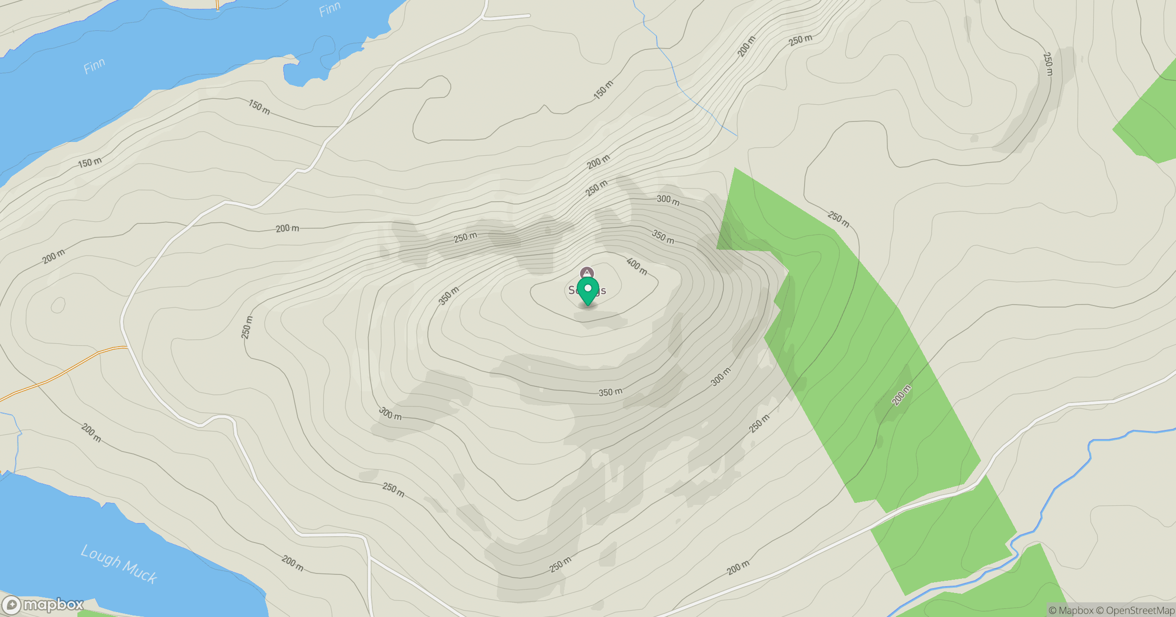
Grid reference: B934013
View on OpenStreetMapOpens a map in a new tab, centred on the hill.
Hills within 30 km
Straight-line distance, not a walking route or confirmation of access.
No comments yet. Be the first.